


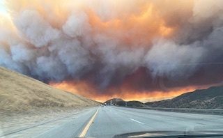
The Hughes Fire exploded to more than 5,000 acres in a matter of hours on Wednesday, creating yet another threat to SoCal residents still reeling from the damage caused by the Palisades and Eaton Fires.
First responders with the Angeles National Forest and the Santa Clarita Valley Sheriff’s office quickly issued evacuation orders and warnings for evacuation zones.
You can check whether you live, work or attend school in a zone that is under an evacuation order or evacuation warning by going to this website.
Red zones on the map are under evacuation orders, meaning there is an immediate threat to your life in those areas. People in those areas must leave immediately, and no one other than first responders can enter.
Yellow zones on the map are under evacuation warnings. There is potential threat to life and property. People in those areas do not need to leave immediately, but anyone who would need extra time under an evacuation order, or people with pets and livestock, should take it as a sign to leave immediately.
Here are the locations with evacuation ORDERS as of 3 p.m., according to authorities. You can paste the zones into the map at this link to see if your house or workplace is under a warning:
- CAS-Romero
- CAS-Halsey
- CAS-Hillcrest
- CAS-Cambridge
- CAS-Sloan
- CAS-GreenHill
- CAS-GoldenState
- CAS-Ridge
- CAS-ParadiseRanch
- CAS-CastaicLake
- LAC-E008
- CAS-CharlieCanyon
- CAS-Biscailuz
- CAS-BitterCanyon
- SCL-KellyJohnson
- SCL-Sterling
- SCL-TesoroDelValle
- LAC-Francisquito
- LAC-E029
Here are the zones under evacuation WARNINGS, as of 3 p.m., according to authorities:
- CAS-OakCanyon
- CAS-ValVerde
- CAS-Industry
- CAS-LiveOak
- SCL-Rye
- SCL-DeCoro
- SCL-WestHills
- SCL-RioNorte
- SCL-RanchoTesoro
- SCL-Calex
- SCL-MountainView
- SCL-BlackPine
- SCL-PacificCrest
- LAC-E030
- LAC-E018
- LAC-E016
- LAC-E011-A
- LAC-E009-B
- LAC-E005
- GOR-E004
- GOR-HungryValley


Here are the road closures in the area near the Hughes Fire, as of 3 p.m. on Wednesday:
- The 5 Freeway, through the Grapevine and north of SR 126. According to the California Highway Patrol (CHP), “The closures will be in place at SR-126 for northbound traffic and at Grapevine Road for southbound traffic. Use Quickmap or Google Maps to find alternate routes.”
- Lake Hughes exit routes (south & north), as of noon with no updates
- Ridge Route Rd at Lake Hughes, as of noon with no updates
- Ridge Route Rd at Templin Hwy, as of noon with no updates
- Lake Hughes at Pine Cyn, as of noon with no updates
- Dry Gulch at San Francisquito Cyn Rd, as of noon with no updates
- Golden State Freeway, as of noon with no updates
- Bitter Cyn, as of noon with no updates
- Sterling Lane, as of noon with no updates
For those with pets or farm animals evacuating from the Hughes Fire, authorities with the Angeles National Forest shared a list of animal evacuation centers on social media.
Here’s the list of evacuation centers for large pets:
- Pierce College: 6201 Winnetka Ave, Woodland Hills, CA 91367
Here’s the list of evacuation centers for small pets:
- Palmdale Animal Care Center: 38550 Sierra Hwy, Palmdale, CA 93550
- Agoura Animal Care Center: 29525 Agoura Rd, Agoura Hills, CA 91301
- Lancaster Animal Care Center: 5210 W Ave I, Lancaster, CA 93536
There is also a temporary evacuation point at Hart High School (24825 Newhall Ave, Santa Clarita, CA 91321).
The Hughes Fire is fast-moving. Check back for updates.
Source: NBC Los Angeles